
IntellinQ
IntellinQ offers GeolinQ. GeolinQ software designed to model, manage, retrieve and share spatial data. Organizations are depending on spatial data like raster satellite images, field observations and elevations models. Managing and combining this data is challenging, because of increasing numbers of data sources. Spatial data can be processed and distributed effectively when the structure of the data and origin of data (metadata) are known and modelled accordingly. This allows fast data retrieval for customized visualization and downloading by searching on metadata and location. GeolinQ offers all needed functionality to model, manage, retrieve and share the data.
Contact Details
IntellinQ
Vasteland 78
3011 BN Rotterdam
The Netherlands
Active in
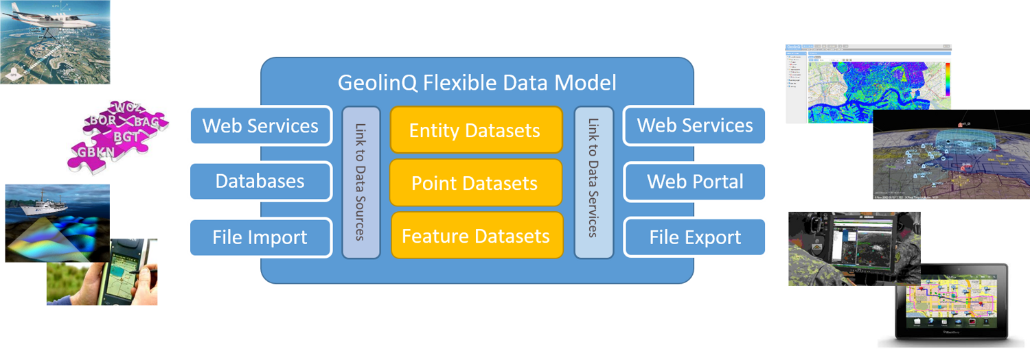
GeolinQ data management concept
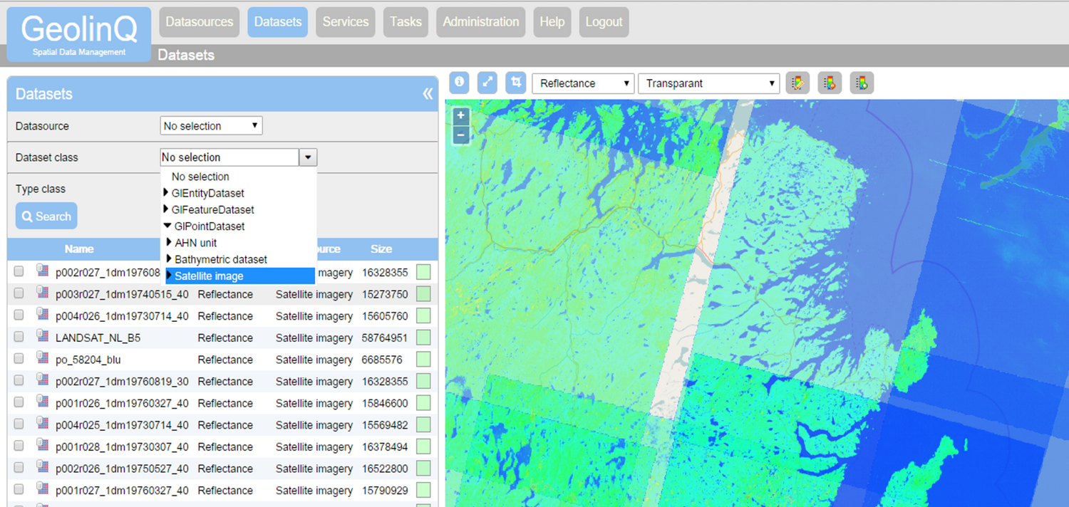
GeolinQ selecting some reflectance datasets
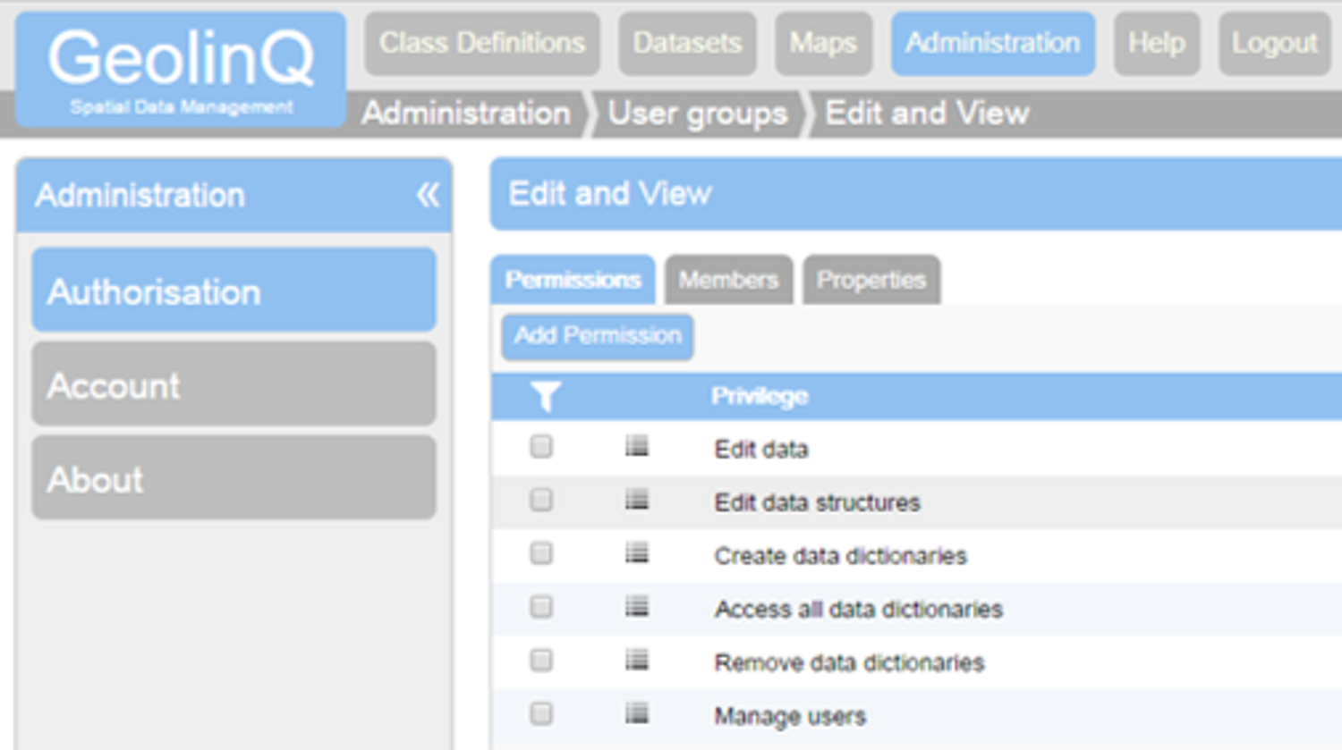
GeolinQ, autorisation functionality
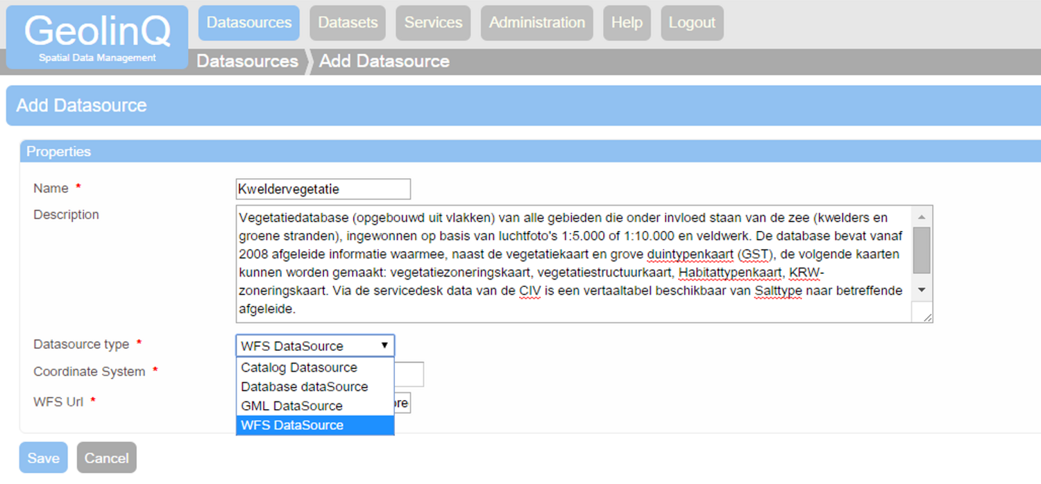
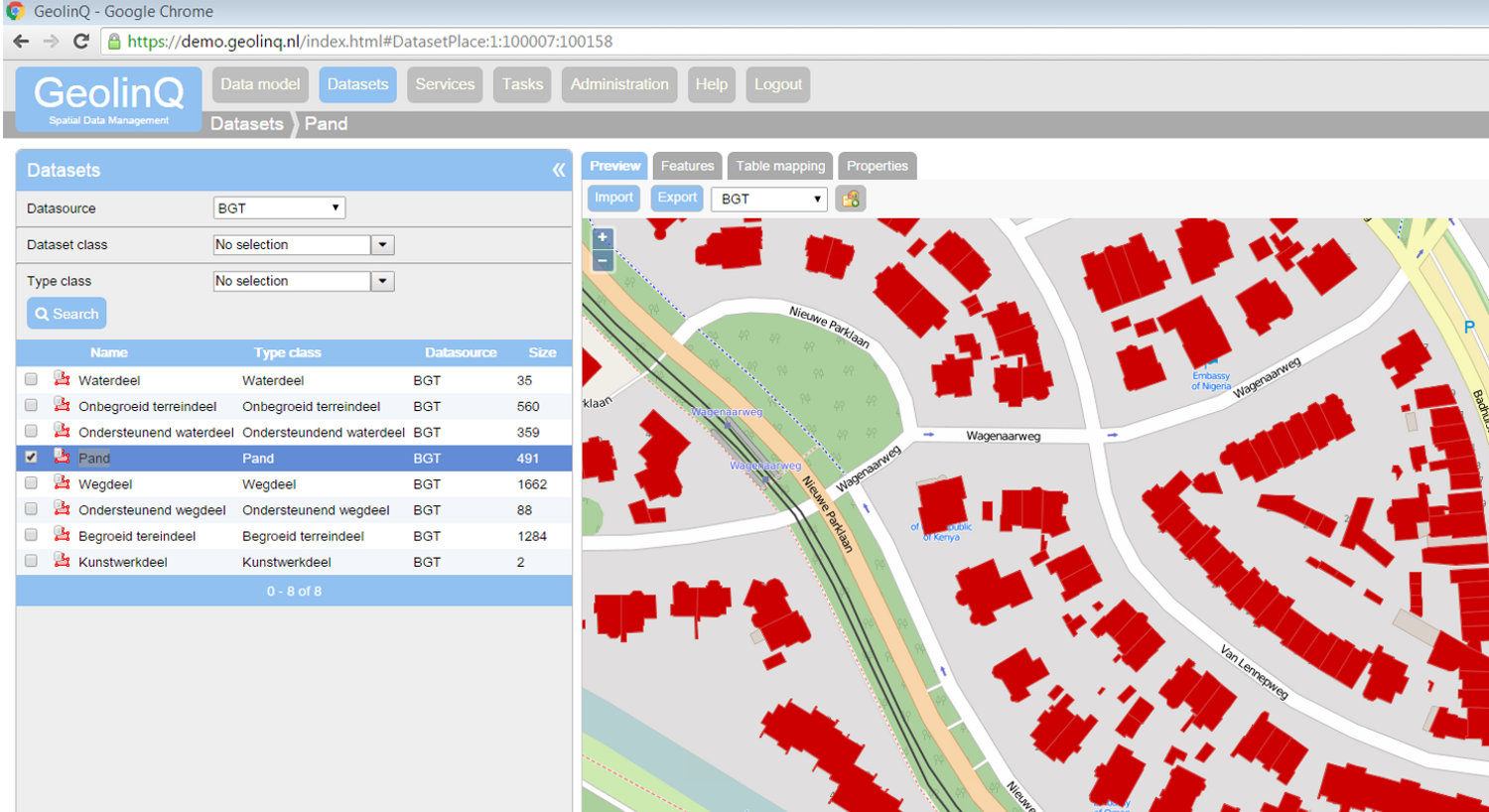
GeolinQ, functionality to integrate data sources including WFS and GML imports
GeolinQ, vector data management